A record of various localnature walks to help me remember the good ones. Not updated since 2017.
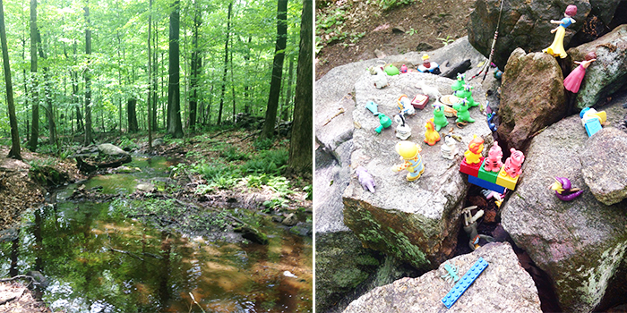
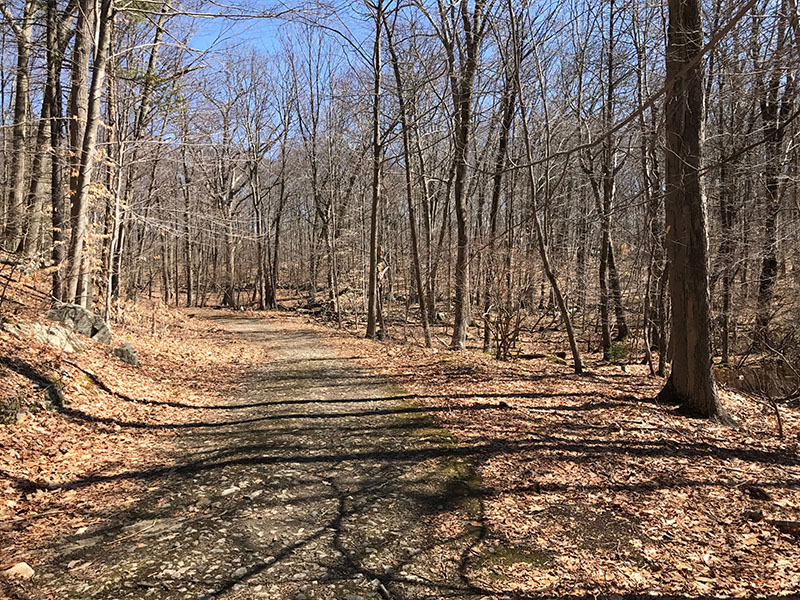
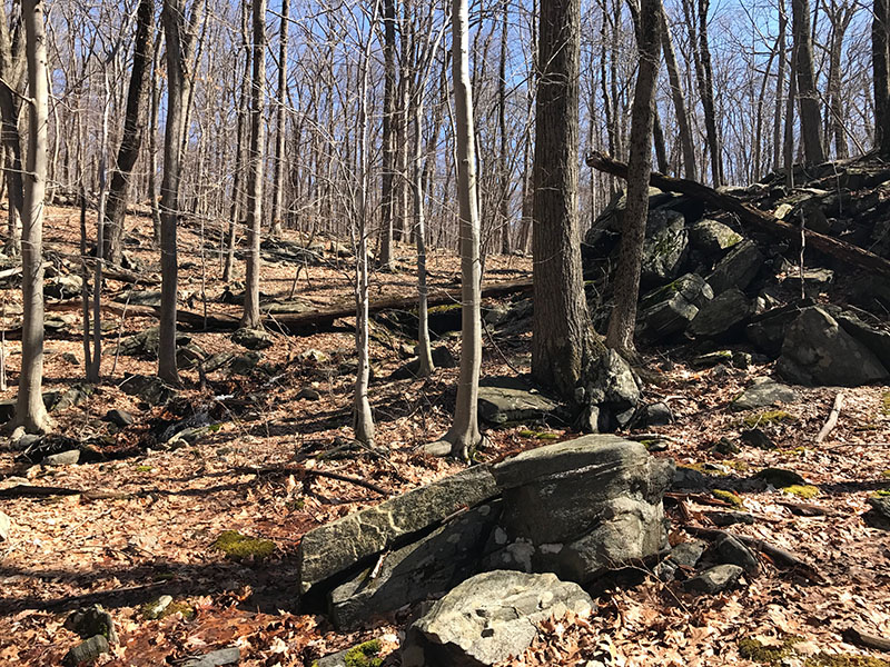
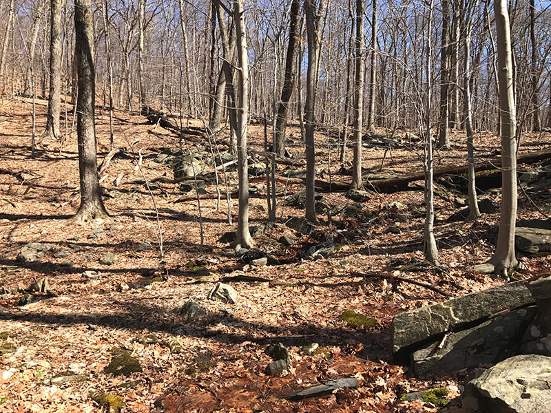
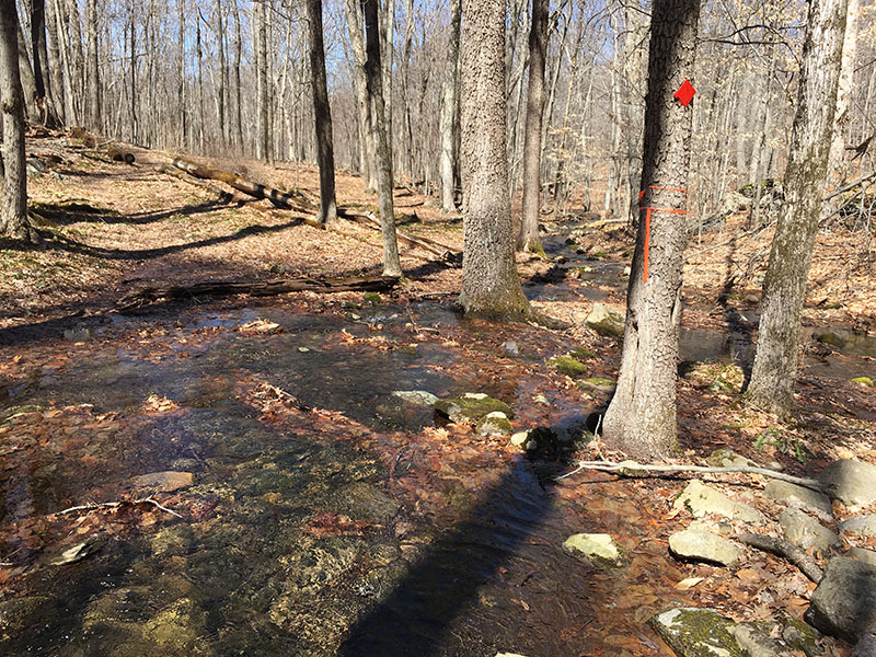
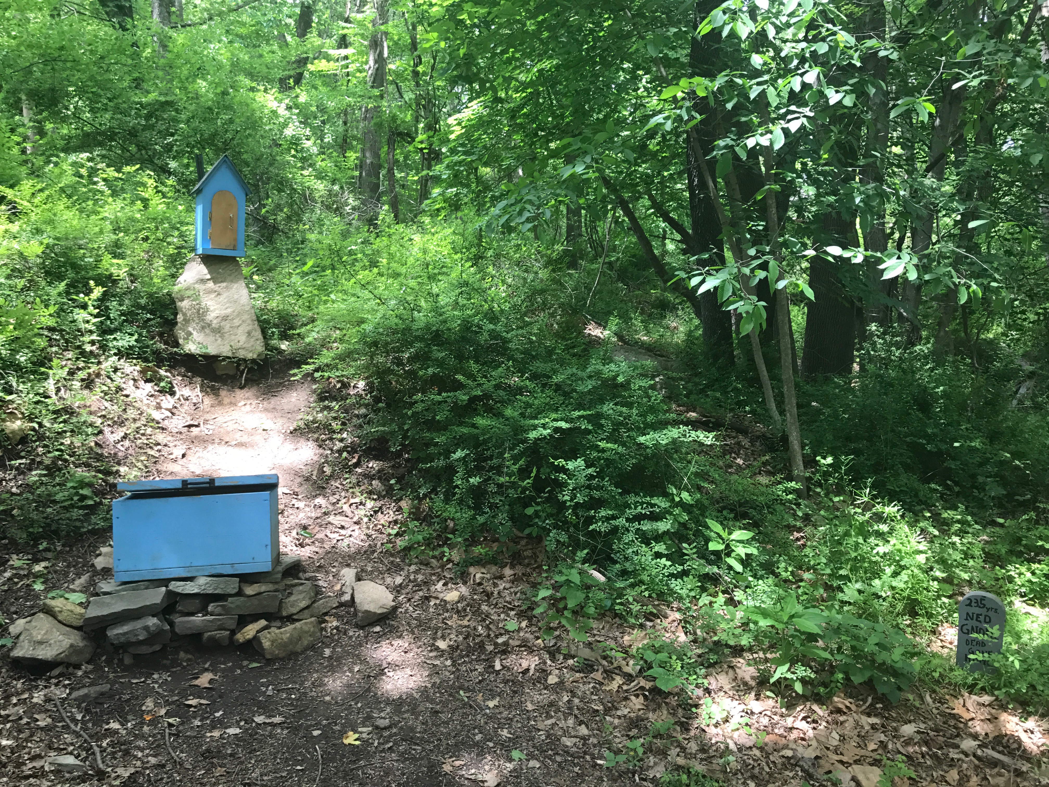
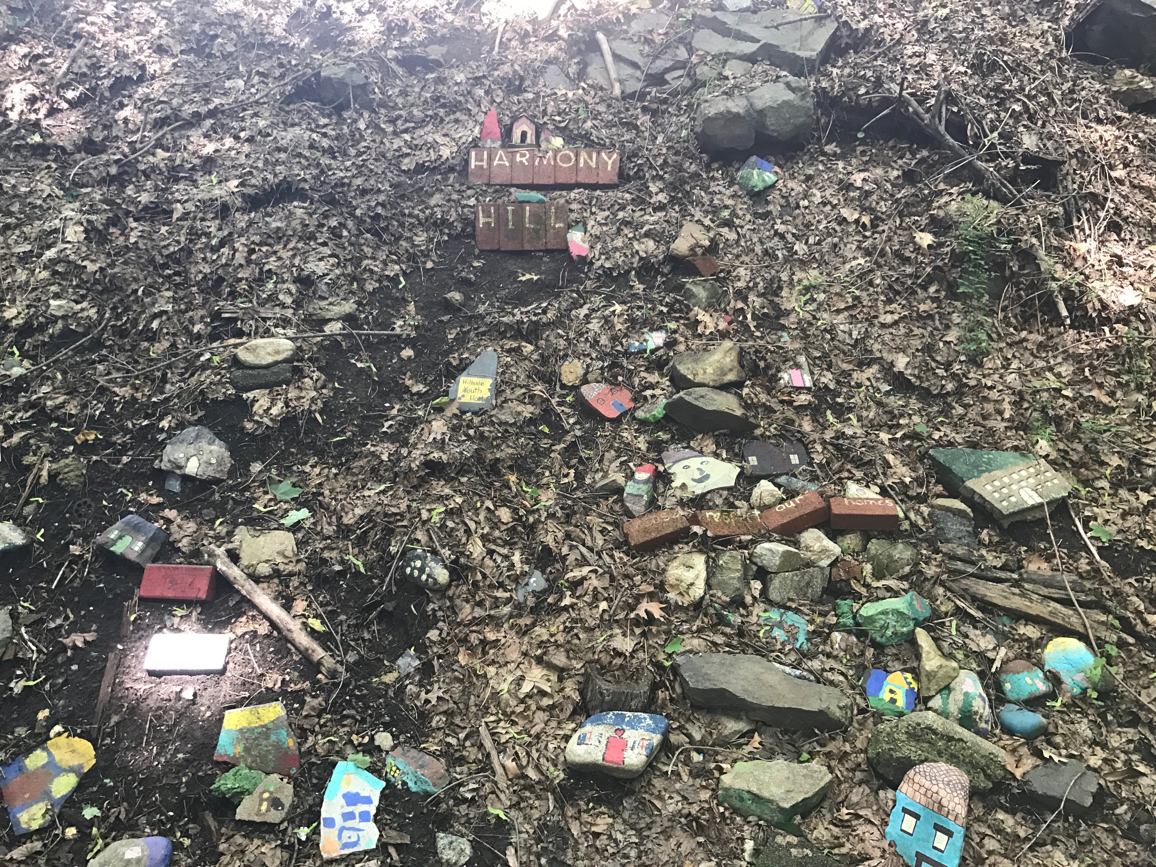
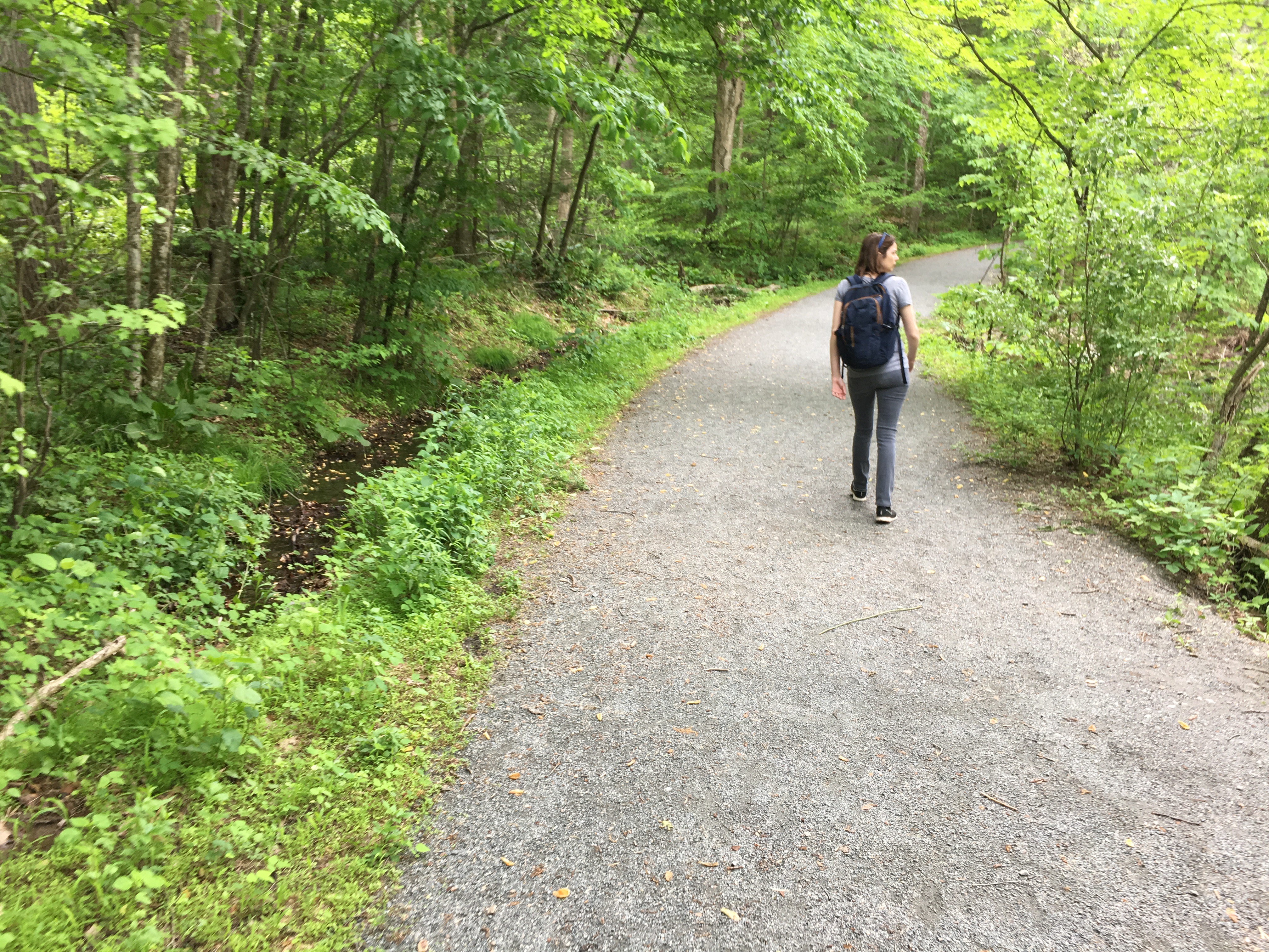
(1) Hardscrabble Wilderness Area, Briarcliff Manor, NY | EASY
Seven marked hiking trails, totaling 3.5 miles, sit within 235 acres of woodland, hills and brooks. The trail entrance is a little hard to find (Use 81 Dogwood Lane, Briarcliff Manor — this is the address of the lovely house adjacent to the entrance and small parking area.) The hikes are flat with a few easy hills. We encountered a handful of other hikers, most of whom were walking with their dogs. Not very scenic but pretty brooks with boulder and bridge crossings and a good variety of trees. We came across a strange menagerie of little plastic toys that was a little creepy! A fellow hiker let us know they were placed there by Girl Scouts. Click to view the trail map, here. | Click to view our strava data, here.
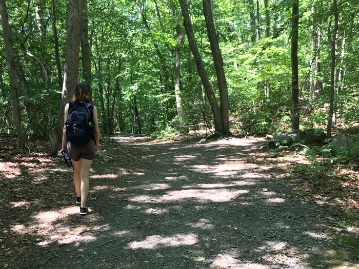
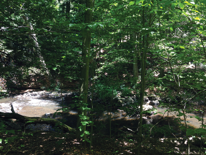
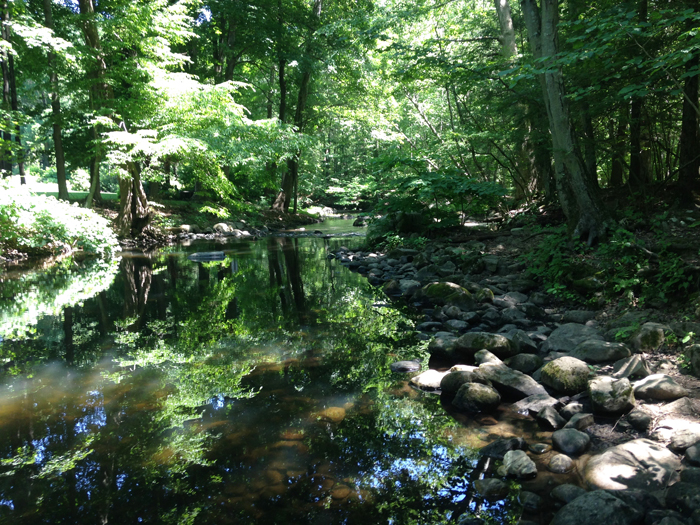
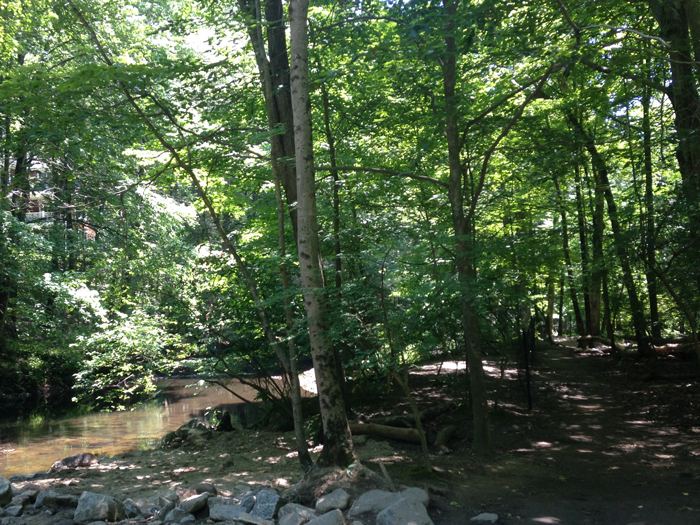
(2) Mianus River Park, Bedford, CT | EASY
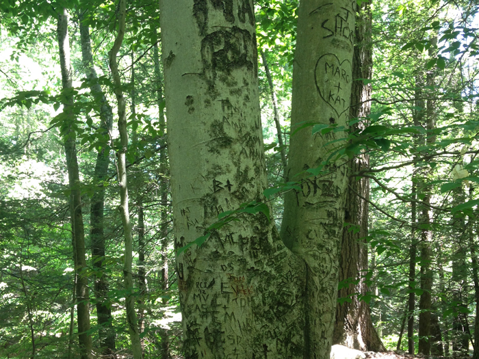
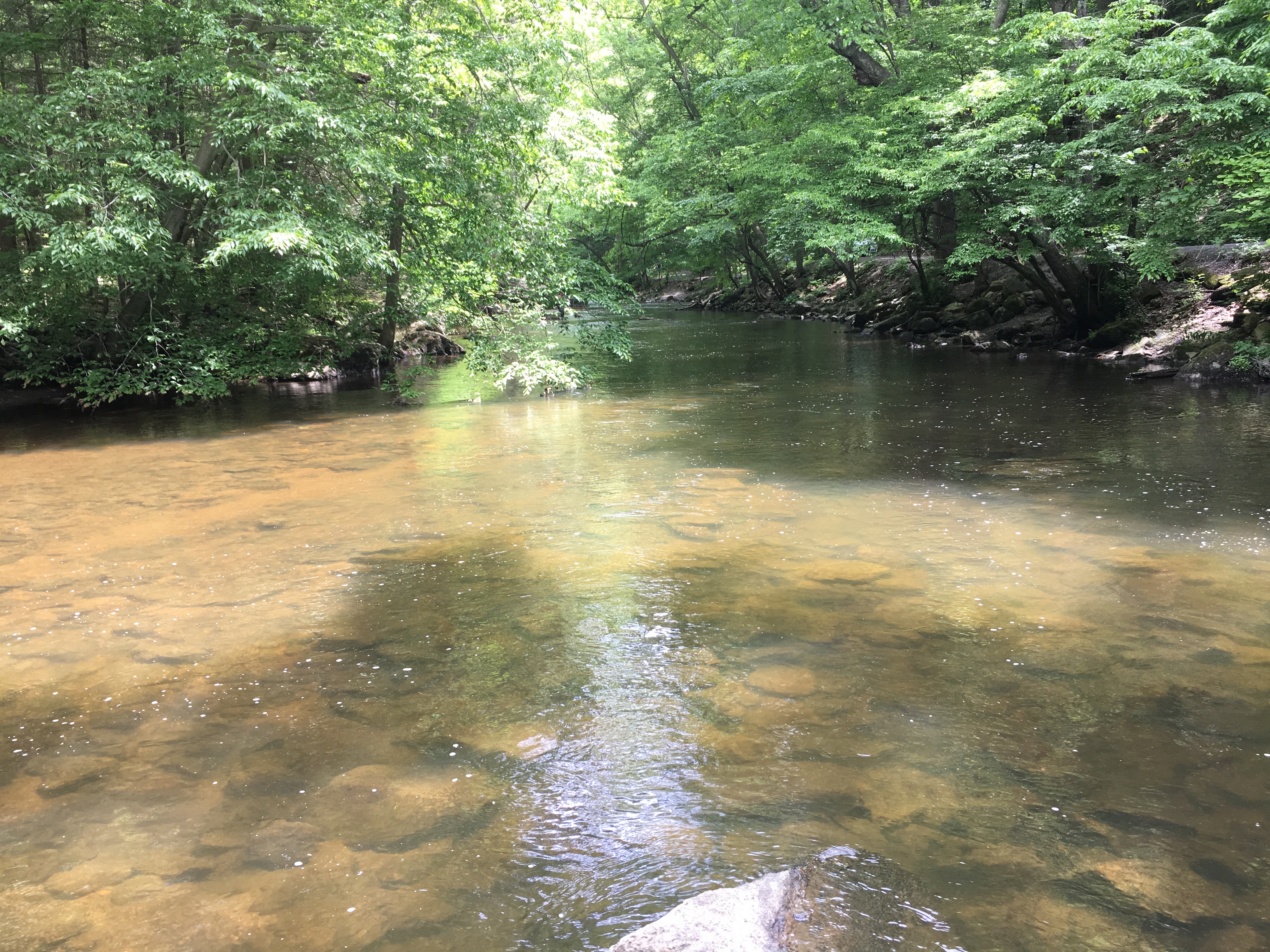
A wonderful 400-acre urban forest sandwiched between Greenwich and Stamford, CT. The Merribrook Lane parking lot was quite large, but also pretty full. Inside the park, there are many different trails to choose from, all shaded by trees. Some of the trails were carriage roads whilst others were thinner and rocky — but all were easy to moderate. Some trails can be used by mountain bikers; we saw a handful of bikers but everyone was very respectful of each other and it was not a problem. The park felt very large and I suspect you could spend many hours wandering around and still not cover all the trails. We saw a deer, many chipmunks, a garter snake and were excited to watch a black crowned night heron fishing for his lunch. We also saw a tree that had been carved all over with love messages and hearts. Trout fishing (catch-and-release) is allowed. The water was clear and we could see the trout swimming. This is a great park for a hike, run or bike, and is suitable for children and dogs. Find more info, here. Click to view the trail map, here. | Click to view our strava data, here.
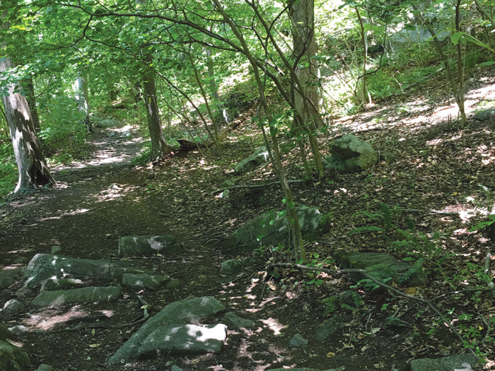
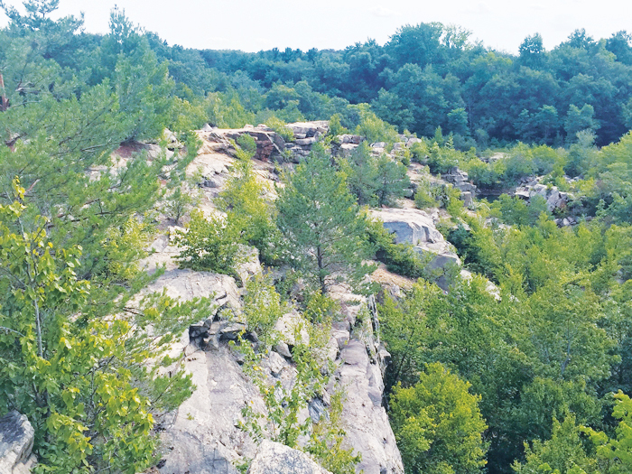
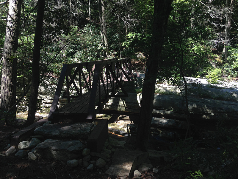
(3) Cranberry Lake Preserve, West Harrison, NY | EASY
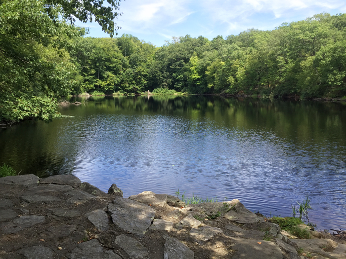
An interesting 190-acre park with a historic quarry (active during the construction of the Kensico Dam, 1913-1917), a four-acre lake, scrubland, wooden bridge, mixed hardwood forest, pools, a bird observation tower, and a swamp. The quarry cliffs were great for scrambling and you can see rusting remnants of the railway that was used to haul the granite from the site. The trails pass a man-made cave known as the “Stone Chamber” and stone walls built by farmers in the 1800s. There is also an eerie abandoned tennis court (from the closed Birchwood Swim Club), and a rusty old car that looked like it was from the 1960s. All in all, lots to find, and the trails were very easy. No dogs allowed. Find more info, here. Click to view the trail map, here.
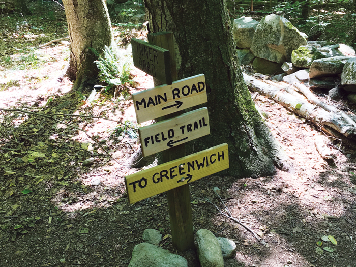
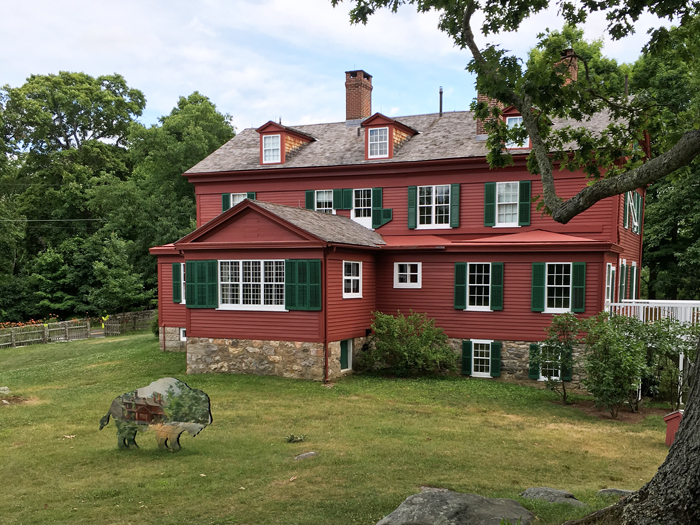
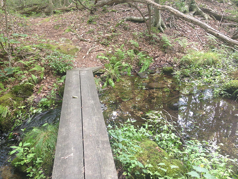
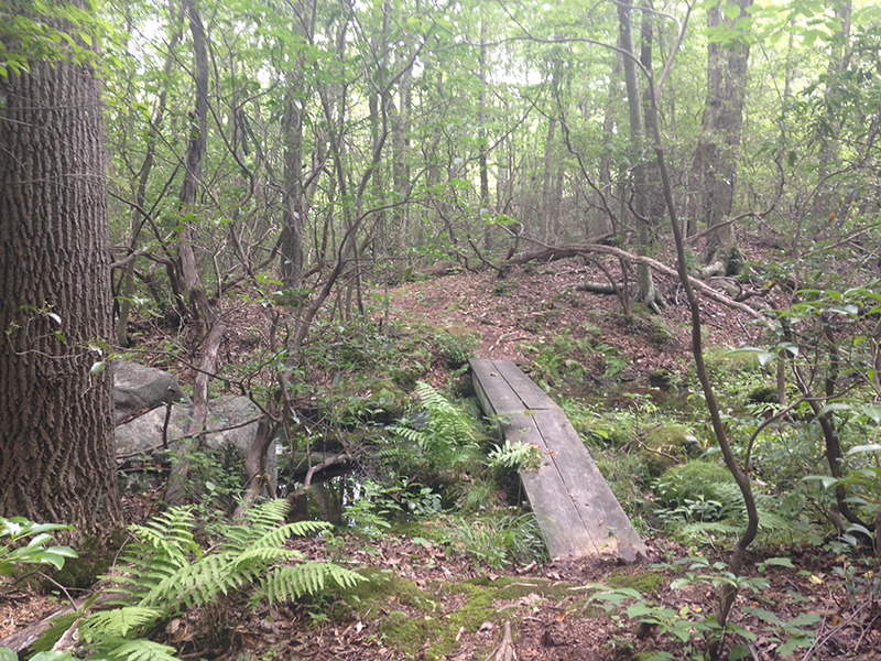
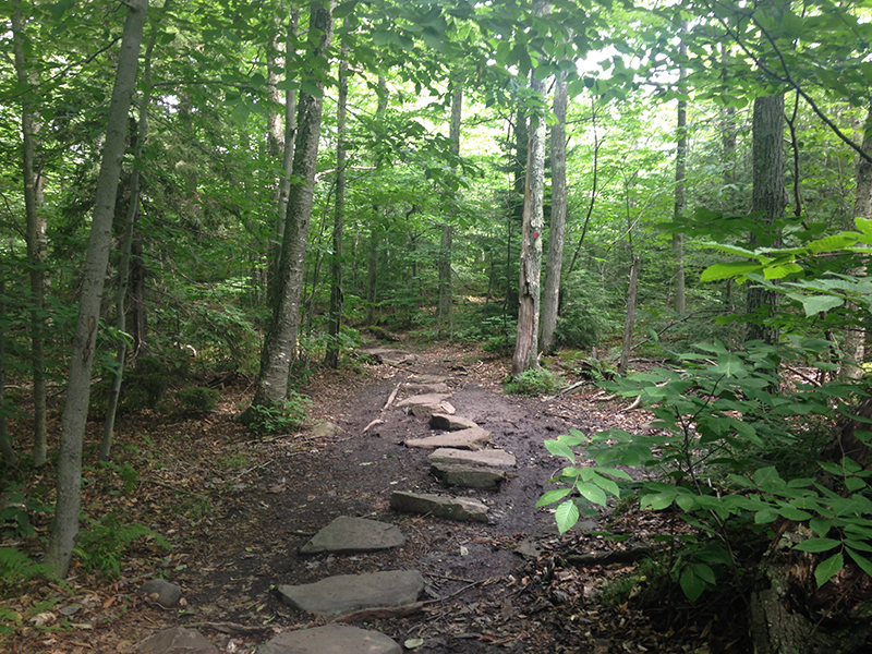
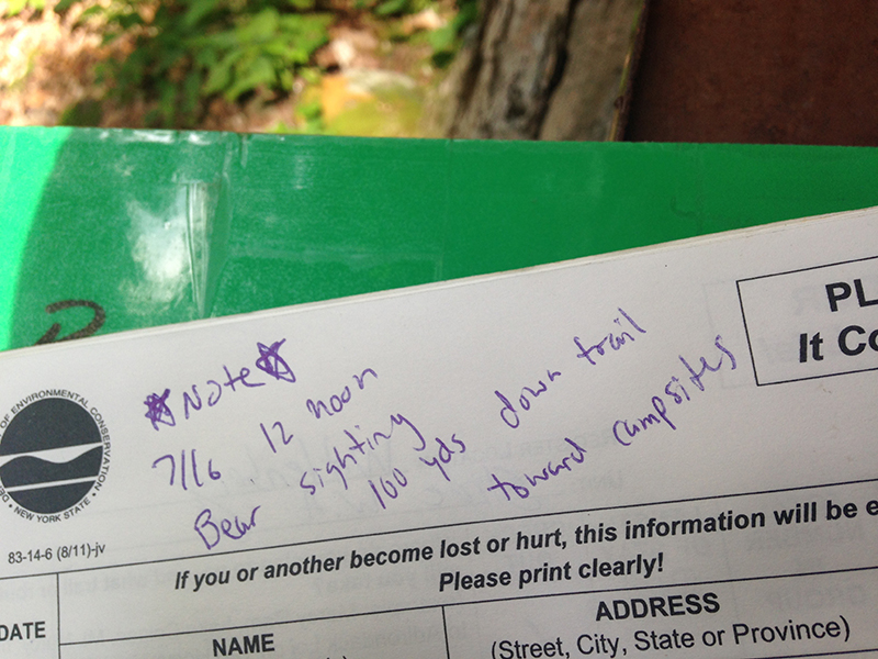
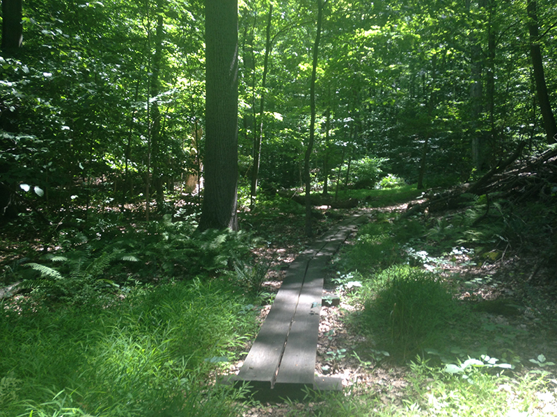
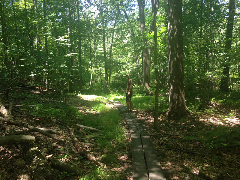
(4) The Weir Preserve, Wilton, CT | EASY Weir Preserve is named for Julian Alden Weir, the noted American Impressionist who owned and farmed much of the property in the latter part of the 19th century until his death in 1919. Weir would hold ‘painting parties’ on the property, inviting his famous artist friends to escape the bustle of New York City and paint outside, in nature, “en plein air”. Preserved by artists, this National Historic Site welcomes everyone to “experience the power of creativity, art, and nature.” The Preserve sits next to Weir’s farmhouse and his two artist studios, all of which are worth a visit (info on free tours, seasonal activities, painting workshops and hours, here). At only 110 acres, the preserve is not very big, but it did offer varied terrain — flower filled meadows that were busy with butterflies, a brook with a wooden boardwalk crossing, rocks and trees. It was not terribly exciting, but definitely worth a stroll if you also plan on spending time at the historic site. There were signs warning of a black bear, but the ranger said he was friendly (!) Click to view the trail map, here.
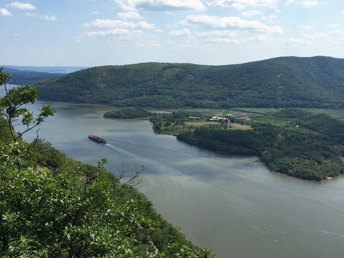
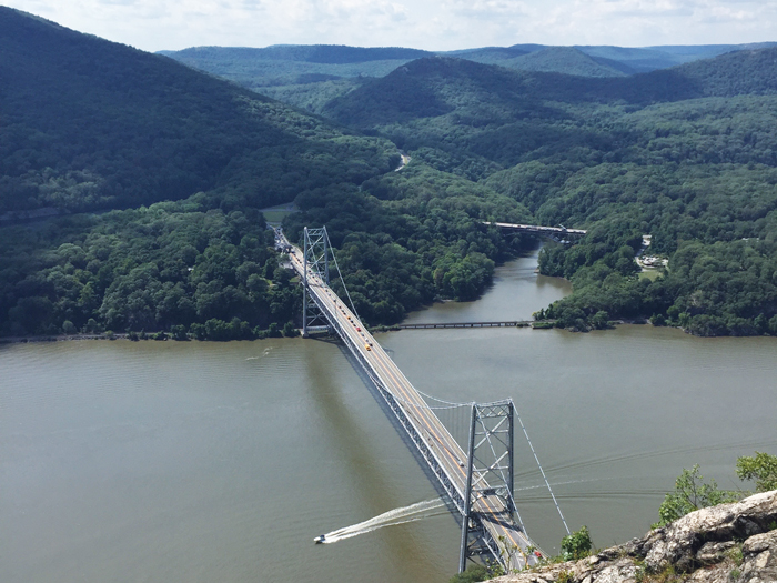
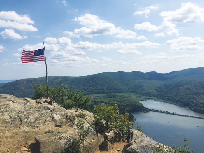
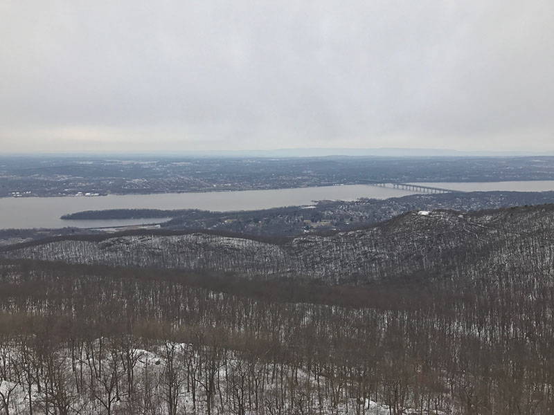
(5) Anthony’s Nose, Cortlandt Manor, NY | MODERATE A great alternative to the uncomfortably crowded Breakneck Ridge is the 2.6-mile round trip Anthony’s Nose hike, so called because the mountain looks like a big snozz. This is not a loop trail, and so you’ll have to retrace your steps to return to your car. There are two trailheads: One is on 9D at the base of Bear Mountain Bridge and the other is at the Anthonys nose II – trail head. Both trailheads are great and are marked on map above. Parking is on the side of the road. Whilst not as technical as Breakneck Ridge, Anthony’s Nose is still very steep (total ascent: 792 ft) and requires a little scrambling. The piece of Appalachian Trail that ascends from Route 9D towards the overlook at Anthony’s Nose is a great stone staircase that is a good workout for the thighs (my husband, a trail runner, ran up it, but I took my time). Once you reach the top the views of Bear Mountain Bridge and the Hudson river are breathtaking. One our descent we met a hiker (Chris) who was a few months into tackling the entire Appalachian Trail — Good luck Chris! Click to view the trail map, here.
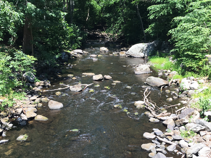
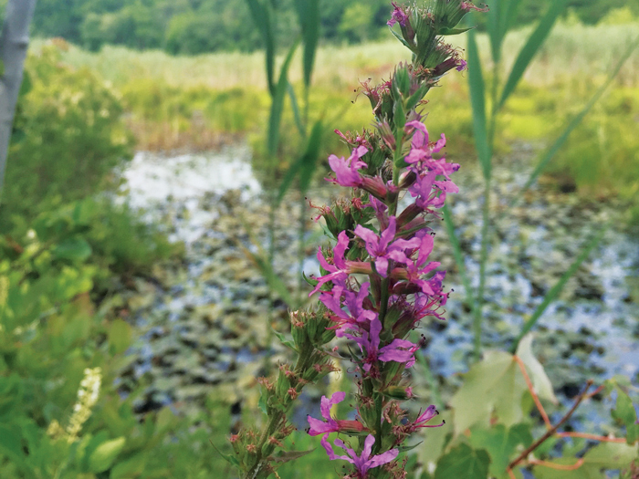
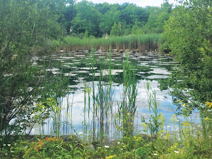
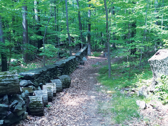
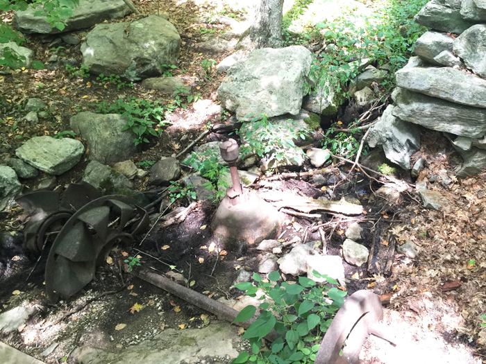
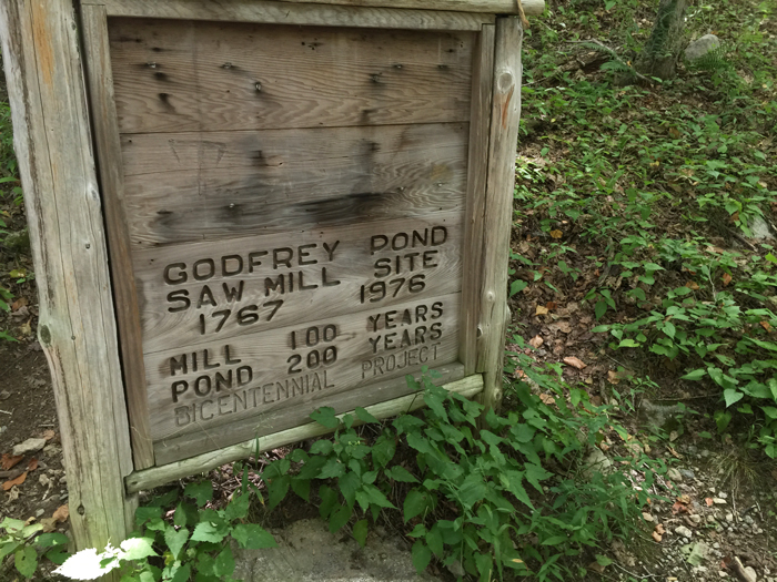
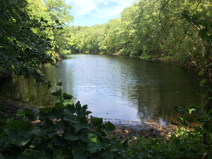
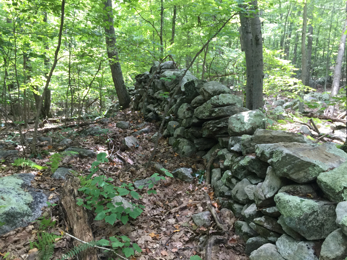
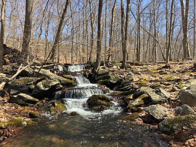
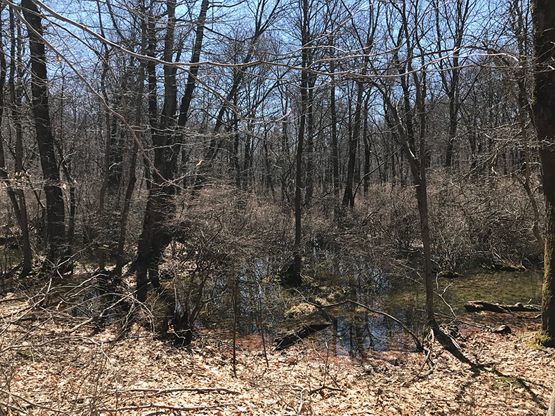
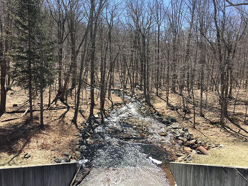
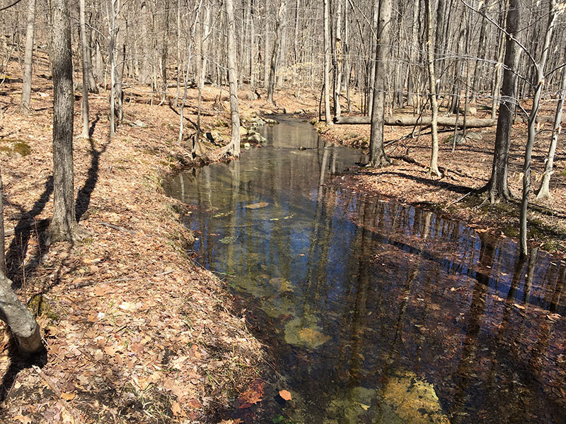
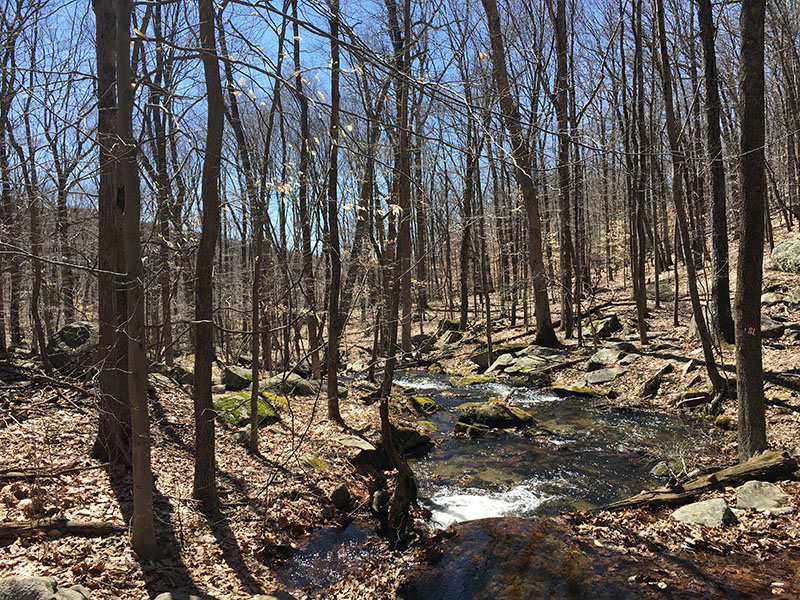
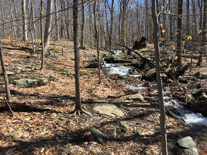
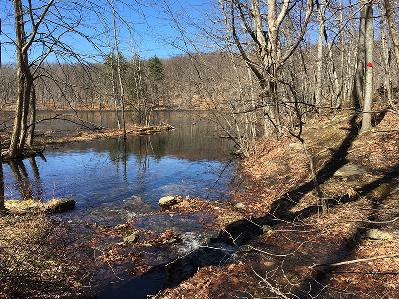
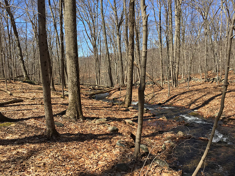
(6) Devil’s Den Preserve, Weston, CT | EASY Devil’s Den Preserve in Weston, CT, encompasses 1,746 acres making one of the larger preserves in the metropolitan New York area. The preserve’s name derives from local lore: charcoal makers in the hilly, rocky area would say that a hoof-like mark made in a boulder was the footprint of the Devil. The preserve has 20 miles of trails, and maps are available at the Pent Road parking area. The lot may look busy, but once you get hiking you hardly see anyone else. The preserve feels large and you could spend a 2-3 hours walking around. All trails are clearly marked. Good for trail running as there is some elevation, but all gradual. The presence of stone walls and foundations in parts of the preserve suggest that the land was used for farming at some point. Features of particular interest are the rusted remnants of machinery from the sawmill that operated at this location from the late 1800s until 1922; Godfrey Pond, a pretty mill pond created in the 1700s; the Saugatuck Wildlife Refuge, an extensive shrubby marsh along the West Branch of the Saugatuck River; the Great Ledge, a high rock formation with a spectacular view of the Saugatuck Reservoir; and Ambler Gorge, a picturesque ravine with a rocky cascade. Wear bug spray! No biking. No dogs. Click to view the trail map, here
(7) Clarence Fahnestock State Park, Carmel, NY | MODERATE Clarence Fahnestock State Park has many well kept trails with nice views. For a pleasant, not too strenuous hike, take the Blue trail at the north of Canopas lake, to the AT trail for as far as you like (it will be an out and back.) You will likely pass a handful of AT hikers lugging their huge packs but the trail does not feel crowded. After the hike, the concession stand at the lake offers great burgers and there are clean new toilets and showers at the beach. Parking at the lake is $7 all day, or free if you are camping at the Campsite across the road (which I do not recommend on the weekend, read Yelp review here.) The park has many trails so you could spend many visits trying to conquer them all. We have seen deer and black rat snakes, and even saw a beaver at Pelton pond one time. Click to view the trail maps, here (3 different maps in pdf)
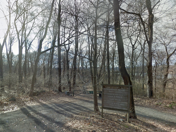
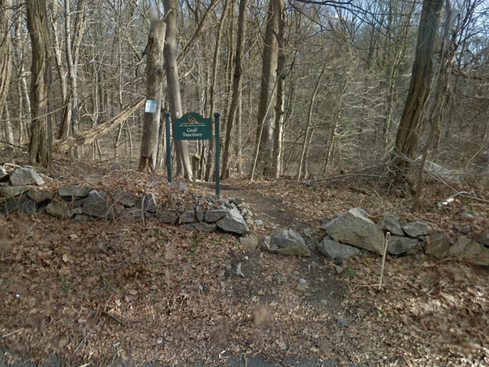
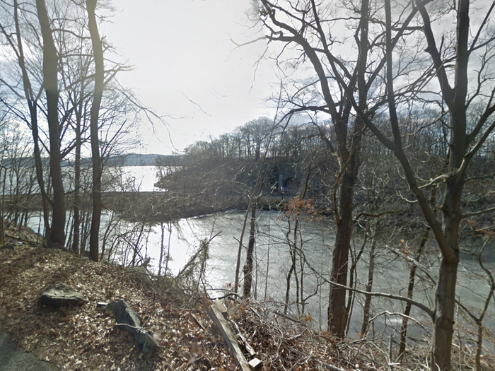
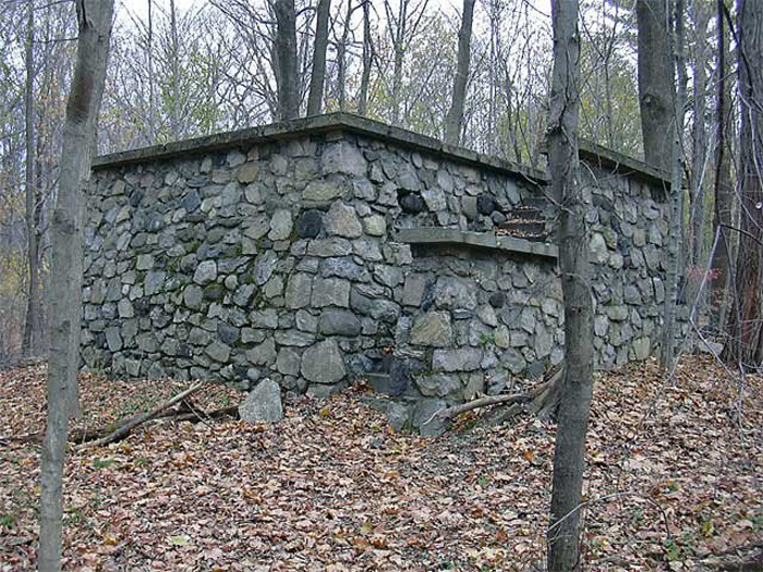
(8) Graff Sanctuary and Oscawana Island Park, Croton-On-Hudson, NY | EASY The park and the sanctuary sit on opposite sides of Furnace Dock Road. Graff is a 29-acre Sanctuary with 1.1 miles of trails; its trailhead is next door to 23 Furnace Dock Road. Oscawana is 160 acres, with 2.9 miles of trail; its trailhead opposite 11 Furnace Dock Road. Both have views of the river and are easy to navigate, despite the Oscawana trails being unmarked. There are a few ruined structures along the trails which add interest; pump house ruins, a 1950s stone comfort station and a fading horse racetrack. Both sites were very quiet and we did not see anyone else during the whole 2 hour hike. The main Oscawana trail leads over the railroad tracks to ‘Oscawana island’ on the Hudson River. You can get right down to the waters edge and dangle your wangles whilst you eat a picnic! What a treat. Click to view the Graff Sanctuary trail map, here. Click to view the Oscawana Island Park trail map, here. (Scanned from Walkable Westchester.)
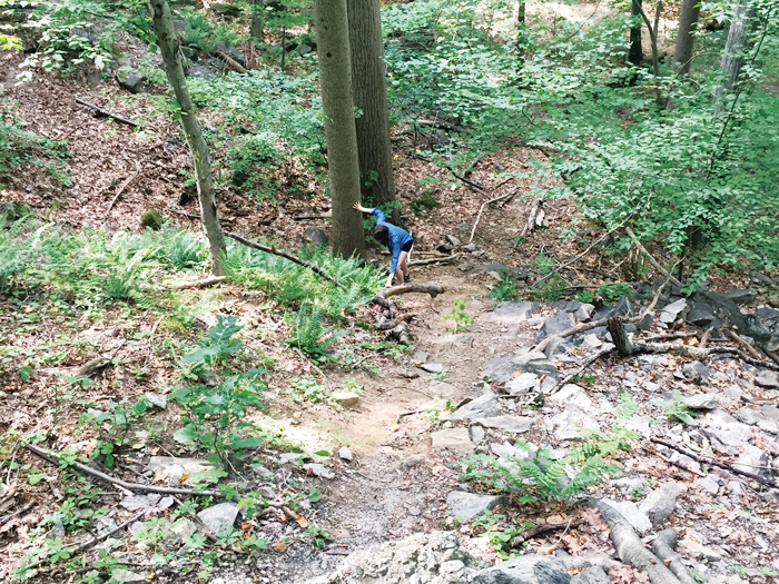
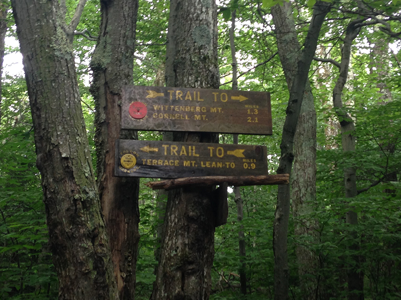
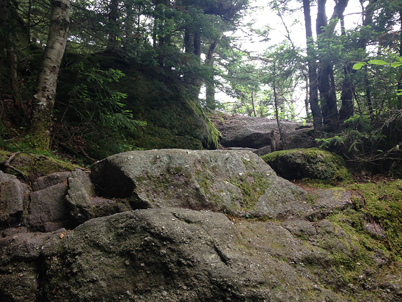
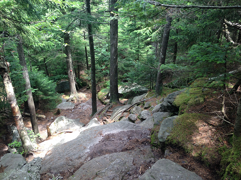
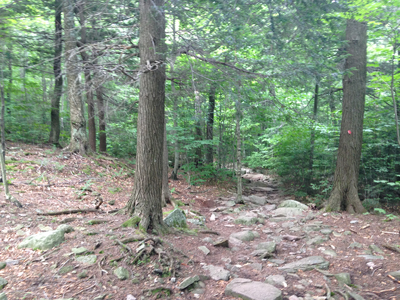
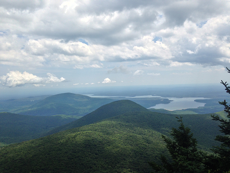
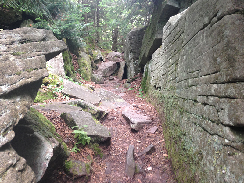
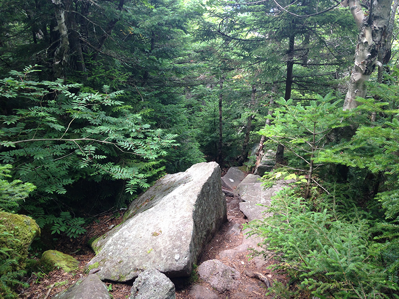
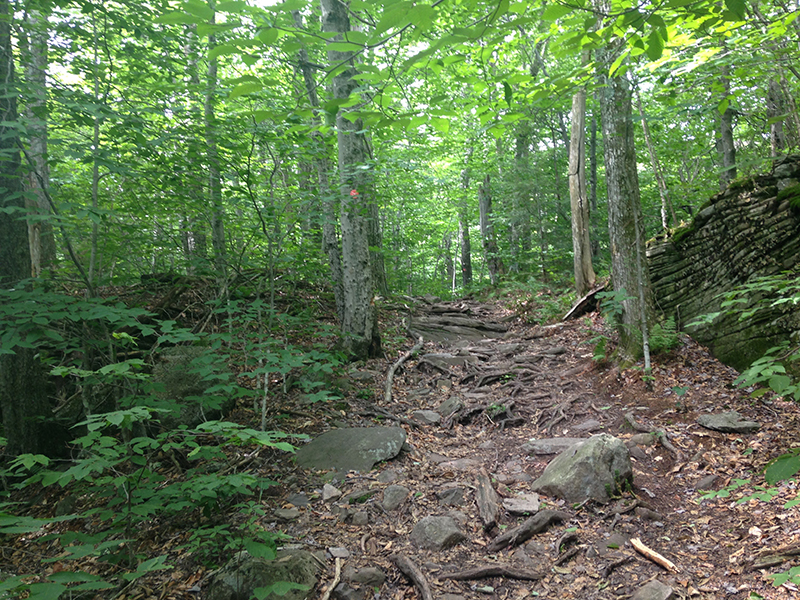
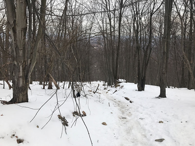
(9) Mt. Wittenberg, Catskills, NY | DIFFICULT Access to the trailhead is across the road from the Woodland Valley State Campground parking lot. Seek out the ranger station to pay for parking otherwise you risk a fine. The out-and-back trail starts at a bridge crossing and then you will immediately start the steep climb up log steps. The trail continues up hill, with some steep sections and some not so bad. After 2.6 miles you’ll reach a marker where the trails splits. Continue to the right to Mt. Wittenberg, on the red trail. Here is where it gets technical — There will be some steep climbs and some scrambling/hauling yourself up over big rocks (my arms are aching today). The view at the top was incredible. A fellow hiker said it was the best possible view of the Catskill mountains. This is not a hike for everyone; the round trip distance is 6.8 miles and 3,780 ft of elevation. The roundtrip hike took me close to 5 hours, which includes my 20 minutes lunch stop at the top. I saw 2 dogs that seemed to be enjoying themselves, though I do wonder how they would manage the scrambling sections. Click to view the Mt.Wittenberg trail map, here.
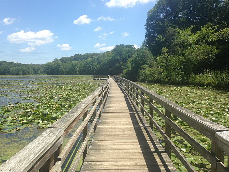
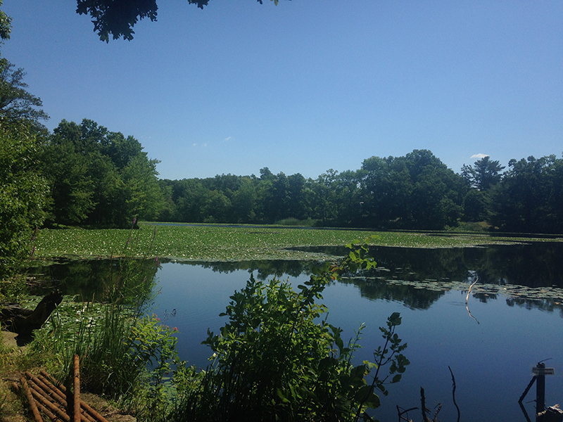
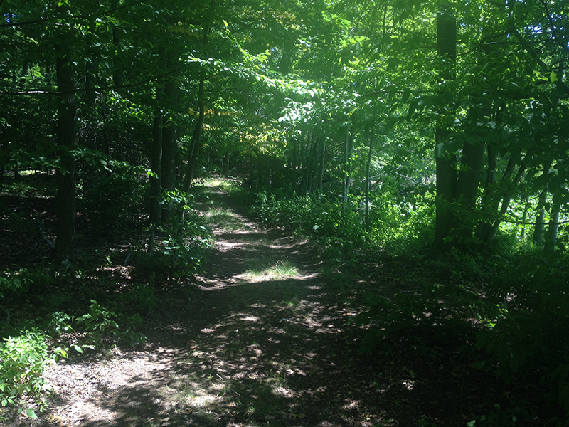
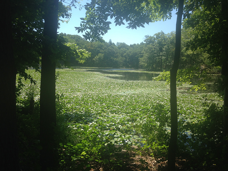
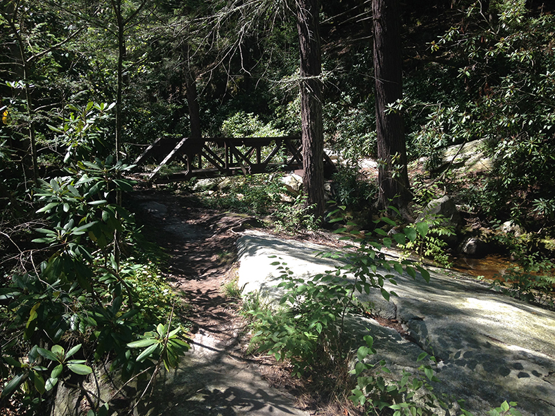
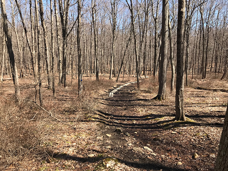
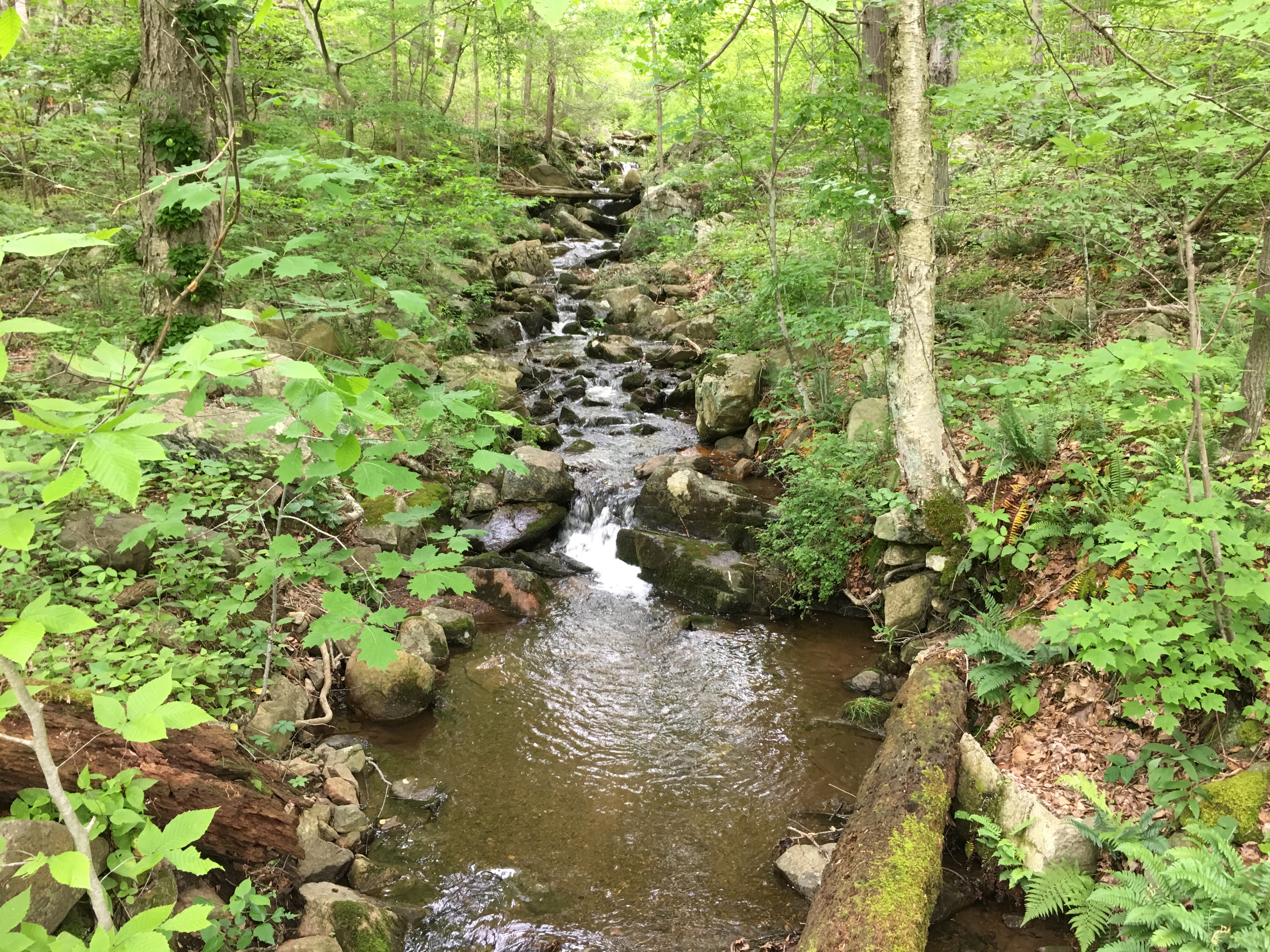
(10) Teatown Lake Reservation, Ossining, NY | EASY Teatown Lake Reservation is a nonprofit nature preserve and environmental education center that includes 15 miles of trails, a wonderful Nature Center (with little gift shop, restrooms, education center and light refreshments), a “Wildflower Island” and boardwalk across the lake. Wildflower Island is a 2-acre sanctuary that is home to 230 native and endangered species of wildflowers, but is accessible by appointment only. The 14 trails pass through fields, mixed hardwood forests, laurel groves, lakes, streams, a waterfall, swamps and farm land. The trails range from easy/novice to moderately difficult. Find out more at the Reservation website, here. Click to view the Reservation trail map, here.
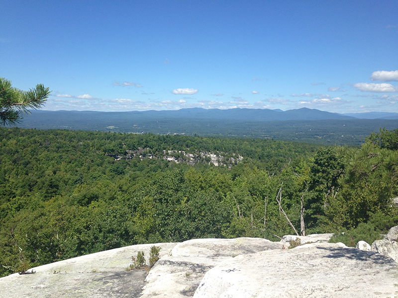
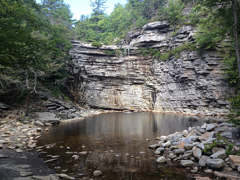
(11) Minnewaska State Park, Kerhonkson, NY | EASY-MEDIUM The Minnewaska State Park Preserve is a 21,106 acre preserve located on the Shawangunk Ridge in New York (“the gunks”). The hikes/walks are wonderful, and the park is stunning — well worth the $10 to park the car. There are three sky lakes within the Park Preserve: Lake Minnewaska, Lake Awosting, and Mud Pond. We visited Lake Minnewaska which is a perfect crystal clear lake, roughly a mile long by a quarter-mile at its widest point. There are hiking and bike trails and cliffs around the lake, and swimming in the lake is permitted. It is very picturesque! We also hiked down to Awosting falls and headed east to the lower parking lot via the AF and RL trail. We then headed back, west, along the BW and HPK trail. We saw outstanding views of the nearby Catskill Mountains along this route. We visited on a Monday and it was quiet, though reading the reviews online, this place can get bustling on the weekend. We plan to return in the Autumn to see the fall views. Click to view the Preserve trail map, here. | The biking routes are here.
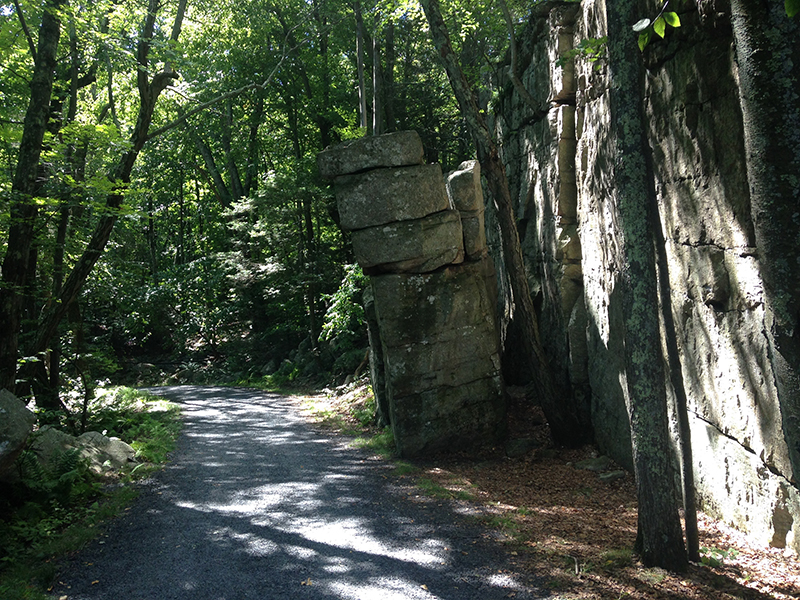
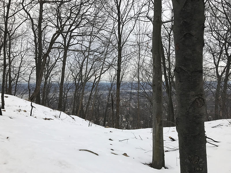
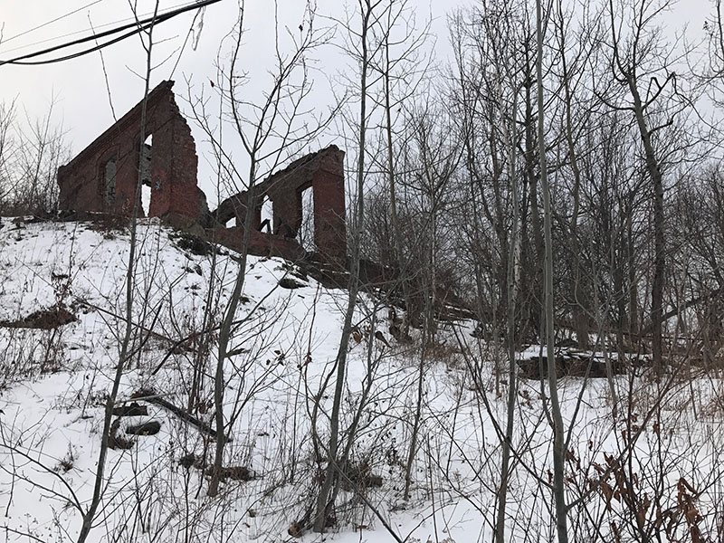
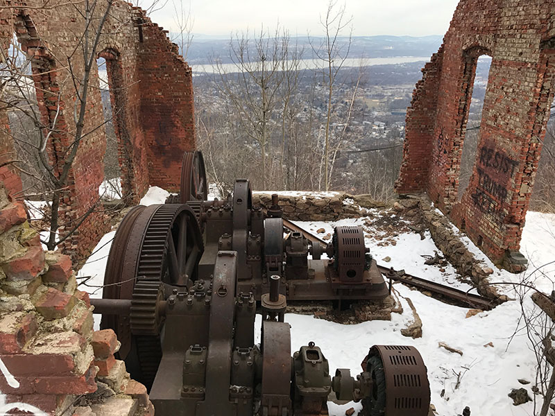
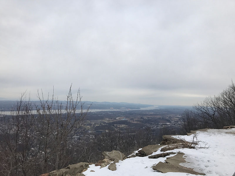
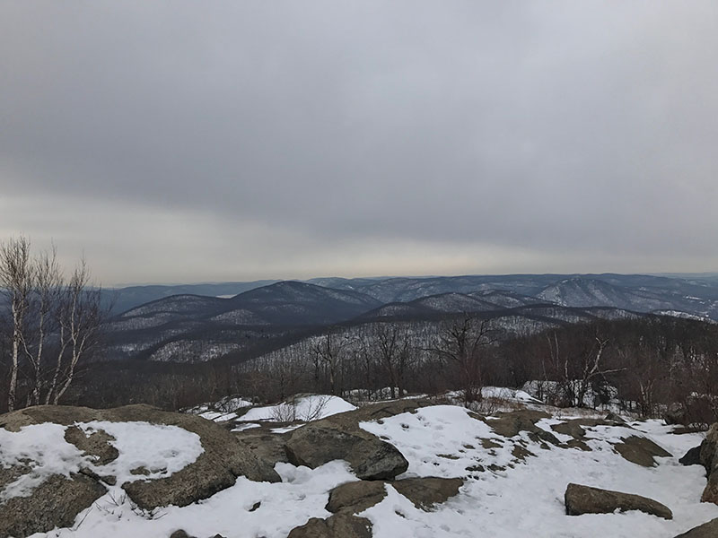
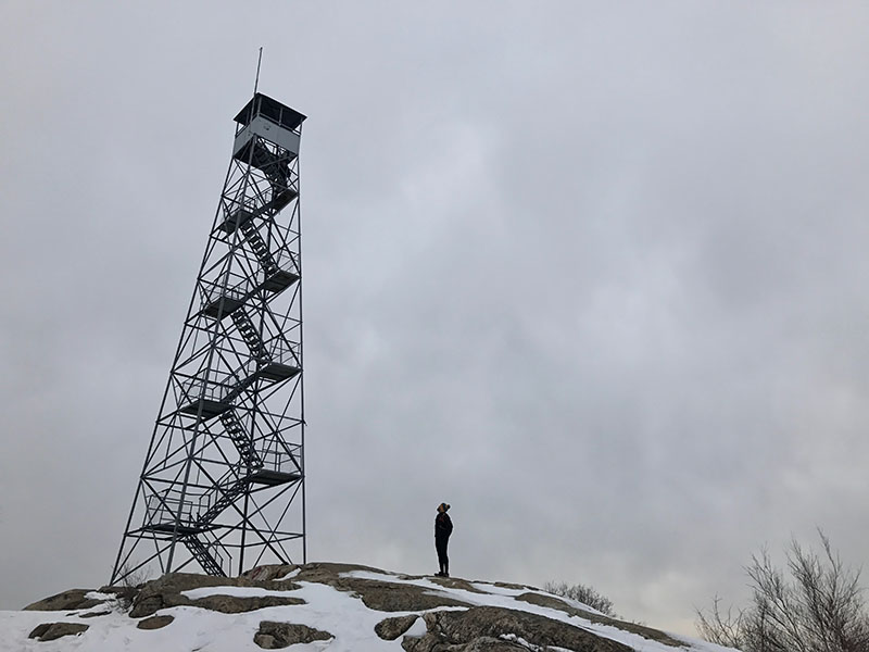
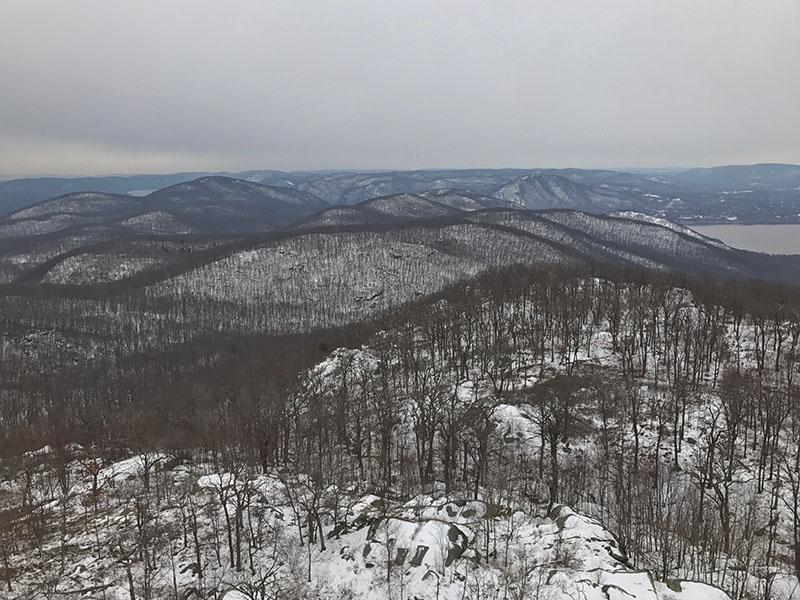
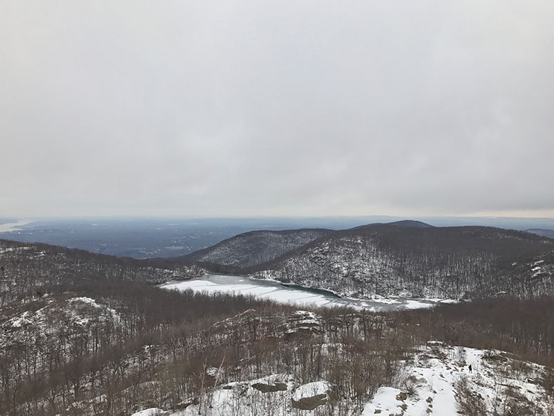
(12) Casino Trail, Beacon, NY | MEDIUM Easy parking in the lot at the trailhead near Bob’s Corner store. From the parking area, follow the red markers along the old road leading past the remains of the Beacon Incline Railway station house. The incline railway ran from 1902 to 1978 — two cars transported thousands of passengers annually up 2,200 feet of sheer mountainside trackway to 1,540 feet above sea-level. It was the world’s steepest passenger railway! (See photos of how it used to look in the slideshow below.) Continue to follow the red trail markers and climb the metal staircase to the trail. There are many switch backs and it is steep. You’ll see the remains of the winch of the incline railway as you reach the top. It looks very cool with it’s rusty gears and red brick — Too bad it is graffiti-ed up. A little to the right are the ruins of the Beaconcrest Hotel is it’s dance hall, the “casino”. There is a wonderful view of the Hudson from here and it is a great place to stop and lunch/snack. We then carried on along the red trail to the fire tower. It was treacherous and icy on our visit and I fell a few times — I should have worn yak tracks! Once we reached the fire tower, the views from the top were awesome; 360 degrees of snowy mountains and river. The whole hike took us 3 hours but I was slow as molasses because I was scared of slipping on the ice. Click to view the Preserve trail map, here.
1907
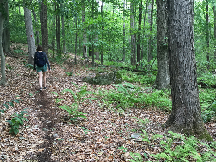
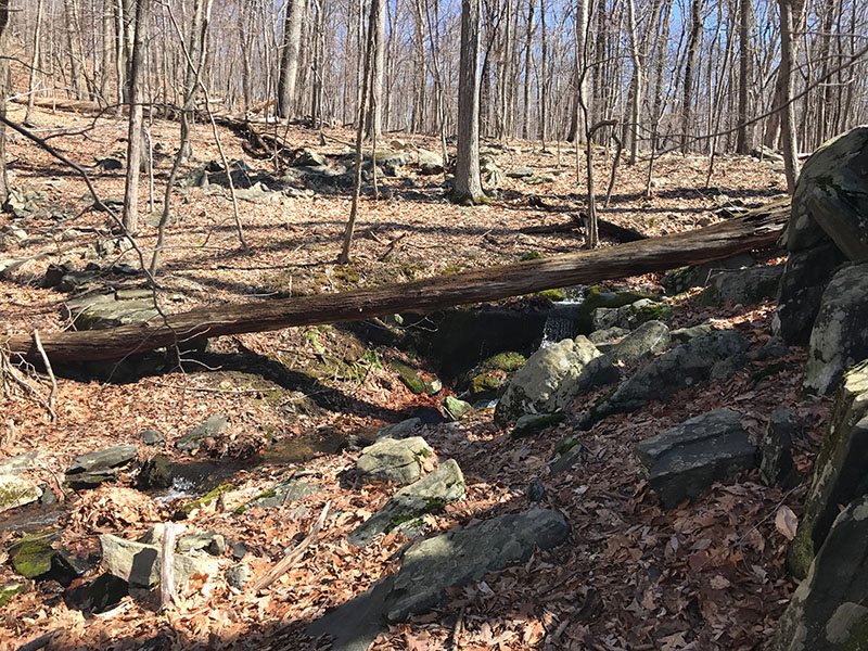
(13) Sal J. Prezioso Mountain Lakes Park, North Salem, NY | EASY/MEDIUM What a lovely place! You could spend hours wandering around the trails here. Beautiful babbling brooks with wooden bridges, pristine lakes, birds chirpings, frogs in chorus … and hardly anyone around apart from a few dog walkers. Delightful! The terrain was varied which kept it interesting — there were some hops over creeks, some rocky sections, road, hills, flat and trail. Nothing too technical, just a nice wander but it felt like a work out. Would be great for runners. We walked 4 miles and barely made a dent because this park is huge! All the trails were well marked and the park felt clean and tidy. Plus there are campsites here! We past a guy preparing his breakfast over a fire pit. His tent was set up in a wooden lean-to (I think ‘Hemlock South’) that was steps away from his car and from a lake .. and there were no other sites a around. We will be planning a camping weekend here soon! We visited in early April but can just imagine this place is bustling in the summer. Click to view the Park map, here.
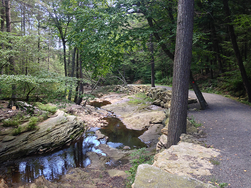
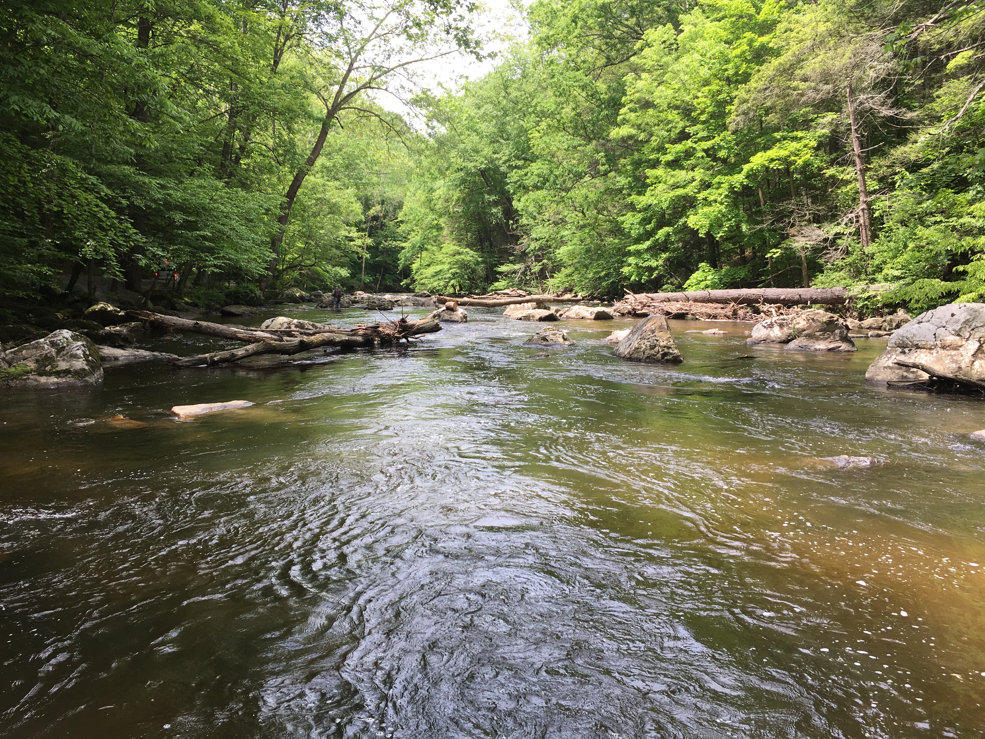
(14) Ken Lockwood Gorge and the Columbia Trail, NJ | EASY Trail info was found here. From the quaint town of High Bridge, we hiked into the scenic Ken Lockwood Gorge along the bank of the South Branch of the Raritan River and return a level up on the Columbia Trail. This former rail line that once transported iron ore from mines in Morris County now passes through a residential area briefly before becoming more remote as it enters Ken Lockwood Gorge. This is an lovely, easy walk (and also very nice for a leisurely bike ride). Along the trail someone had ‘hidden’ tiny fairy houses and toys — Very cute. We crossed the Ken Lockwood Gorge Bridge, a metal bridge constructed in 1891 to replace the original wooden bridge that collapsed in 1885 under the weight of a 46-car train carrying iron ore. Ken Lockwood Gorge is best known as a trout fishing destination and we did see many fishermen wading in the waters on Memorial Day weekend. It was very peacefiul and pleasant. Afterwards we bought sandwiched from Hilltop Deli & Catering and ate them at Voorhees State Park (it was surprisingly empty so we pulled our car into a camp site and lay on the grass, in the sunshine.) Click to view the trail maps, here and here.
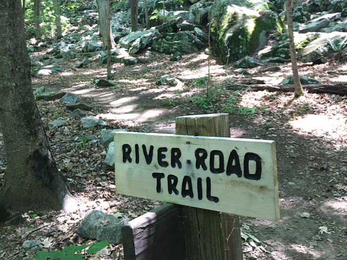
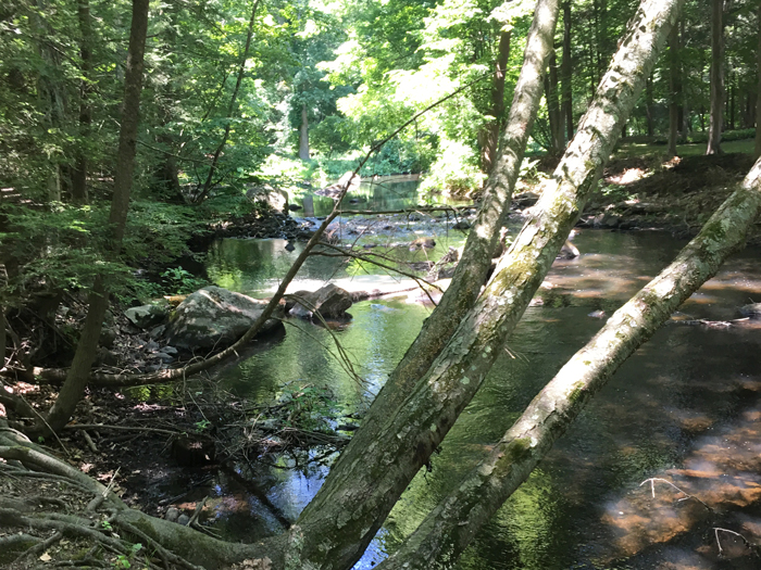
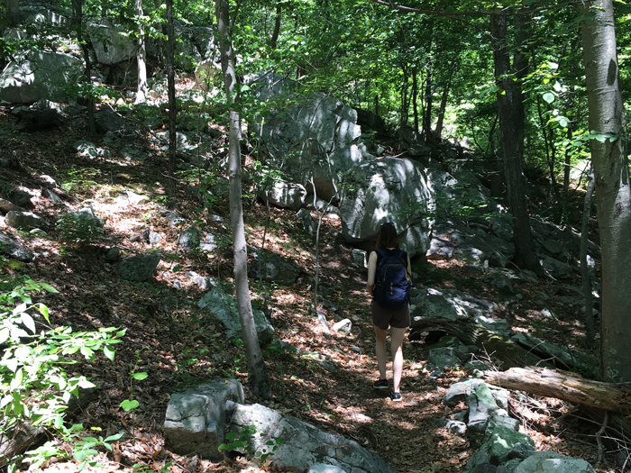
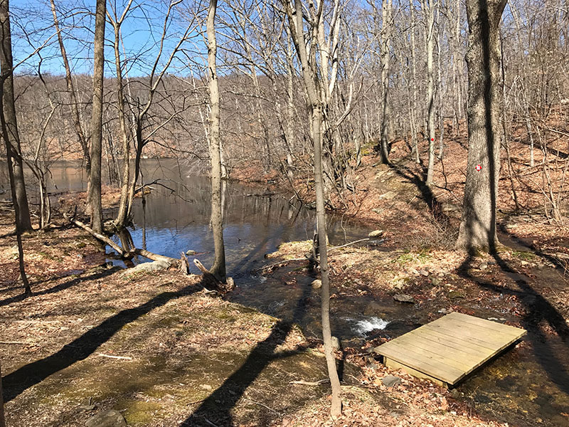
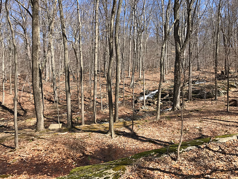
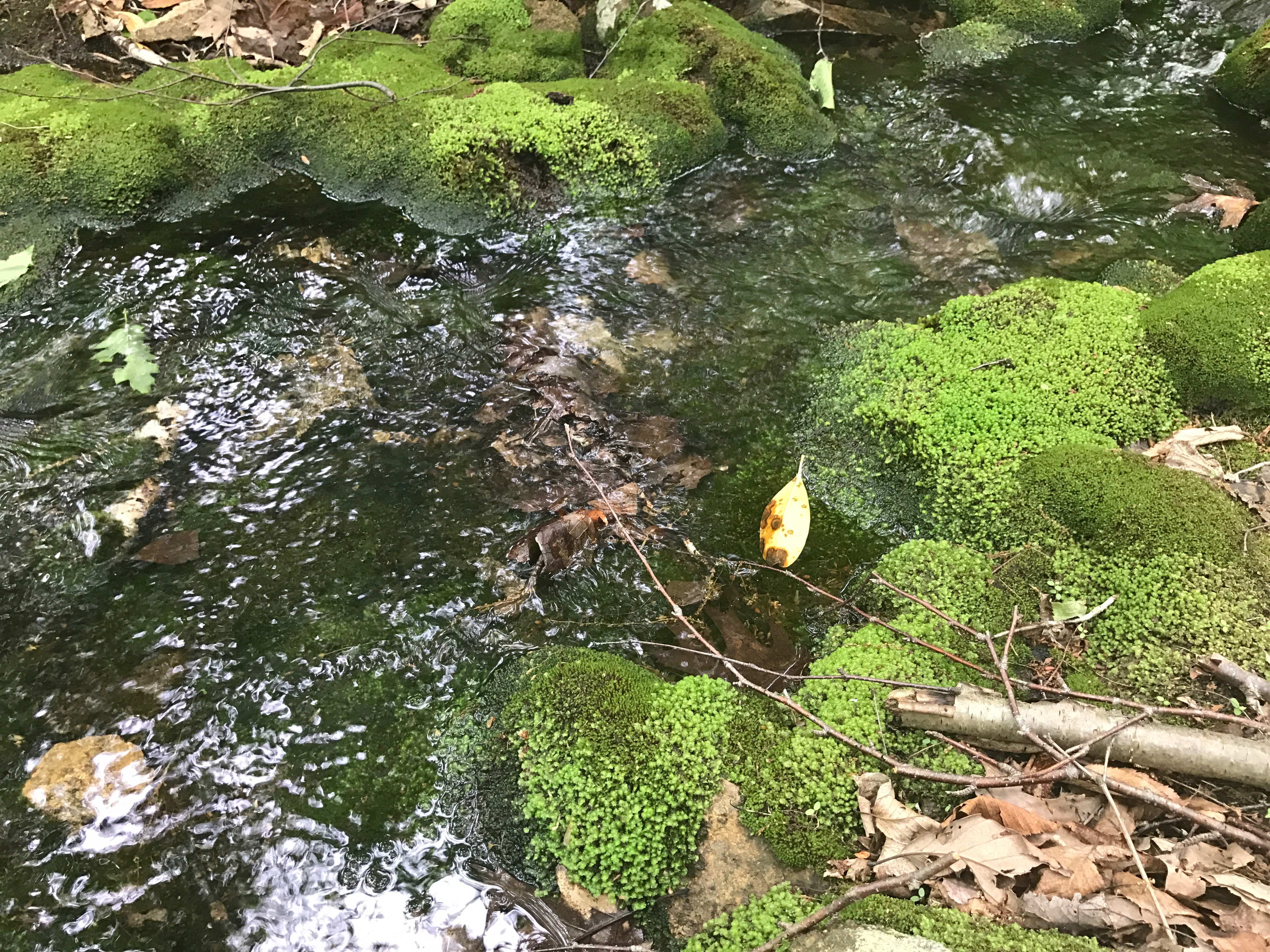
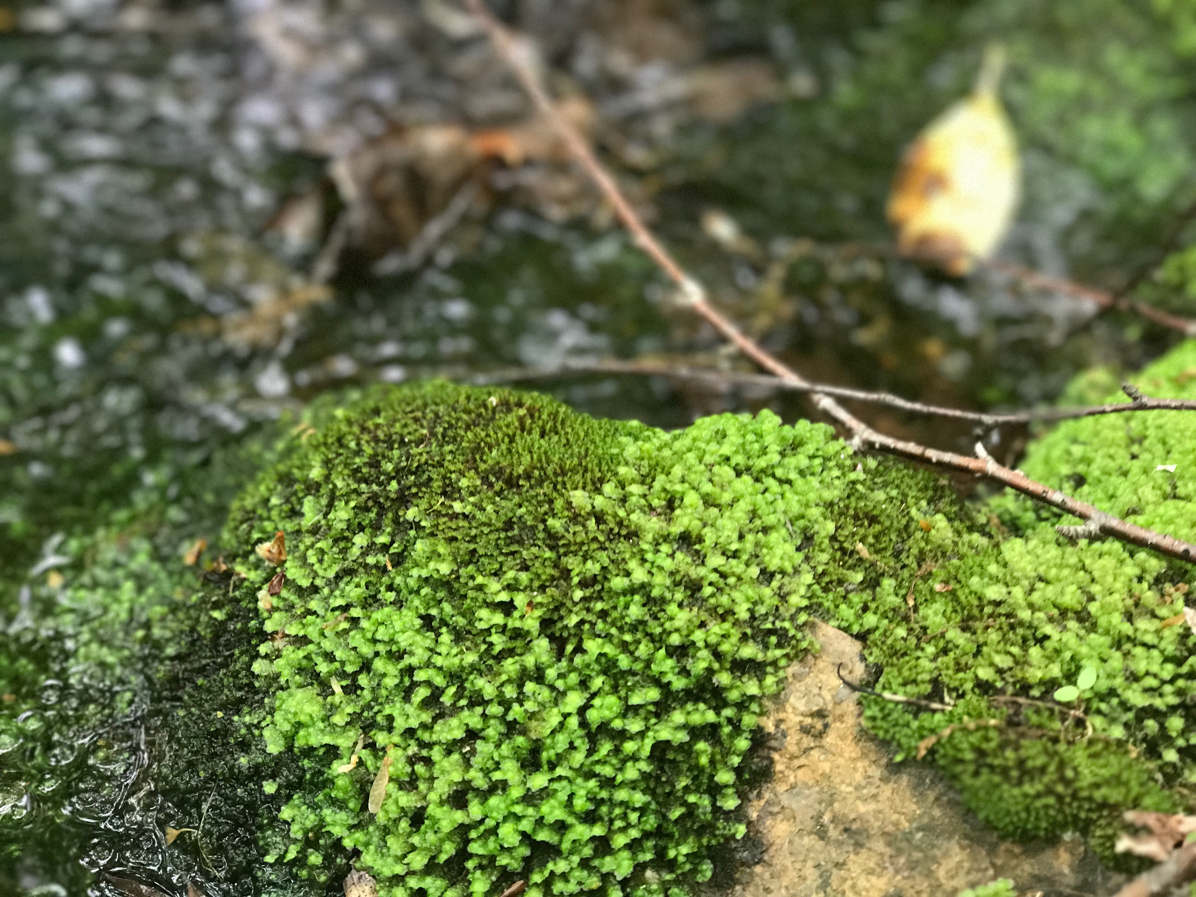
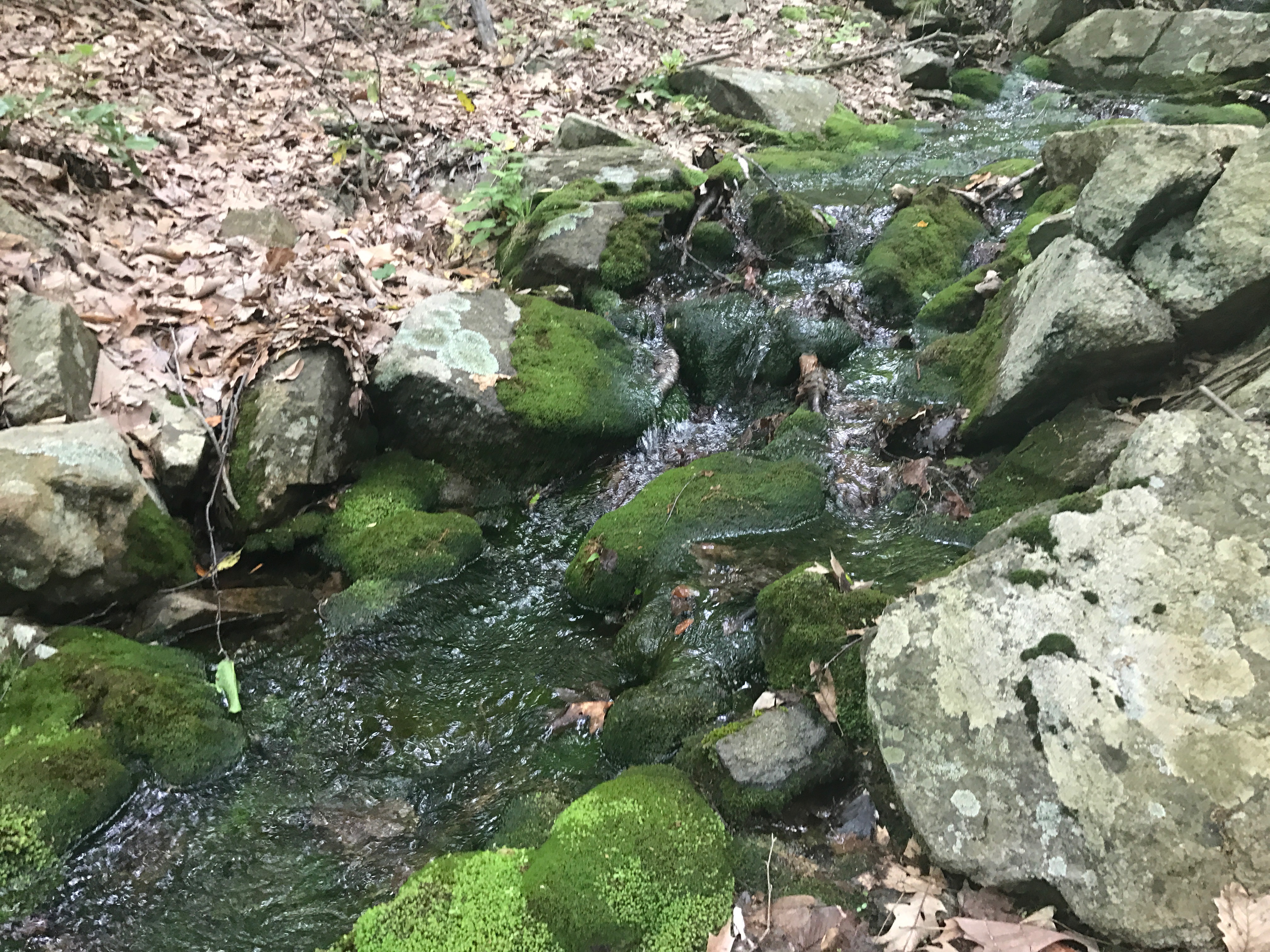
(15) Reeves Brook/Raccoon Brook Hills/Pine Meadow Trails, NY | EASY/MEDIUM Trail info was found here. A brilliant hike! I was concerned because there were many people at the visitor center/parking lot (I thought the trail would be mobbed) but we did not encounter too many other folks until we got to the very end of the hike. So many nice vistas and walks along the brook and ending along the river — the mossy brooks and babbling waters felt like fairy glens. We were lucky that it was not too hot, but I imagine can get very buggy in the summer. Highly recommended – though I did not take hardly any photos! Click to view the marked up trail maps, here. https://www.relive.cc/view/1021189564
Playgrounds, nature trails, museums, food and other things to do. Westmoreland Sanctuary 260 Chestnut Ridge Rd, Mt Kisco, NY 10549 | website | trailmap A not-for-profit, independent nature center and wildlife preserve, established in 1957. A 7-mile trail system with some steep hills, and a
Playgrounds, nature trails, museums, food and other things to do. Westmoreland Sanctuary 260 Chestnut Ridge Rd, Mt Kisco, NY 10549 | website | trailmap A not-for-profit, independent nature center and wildlife preserve, established in 1957. A 7-mile trail system with some steep hills, and a
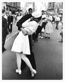
V-J Day in Times Square (also V-Day and The Kiss) is a photograph by Alfred Eisenstaedt that portrays a U.S. Navy sailor grabbing and kissing a stranger—a woman in a white dress—on Victory over Japan Day (“V-J Day”) in New York City’s Times Square on August 14, 1945. From looking at shadows, experts deduced that
V-J Day in Times Square (also V-Day and The Kiss) is a photograph by Alfred Eisenstaedt that portrays a U.S. Navy sailor grabbing and kissing a stranger—a woman in a white dress—on Victory over Japan Day (“V-J Day”) in New York City’s Times Square on August 14, 1945. From looking at shadows, experts deduced that
This mural is for sweet Boo (little Sebastian Henry, aka Velcro Baby) for his first birthday. His parents wanted something not too babyish to ensure that it might last for a few years—so it was out with the initially proposed elephant and monkey, and in with trucks and
This mural is for sweet Boo (little Sebastian Henry, aka Velcro Baby) for his first birthday. His parents wanted something not too babyish to ensure that it might last for a few years—so it was out with the initially proposed elephant and monkey, and in with trucks and
I am not sure who to credit this recipe with because the website that originally listed it is now 404 page not found. To whomever invented this recipe, my hat is off to you. It is easy and delicious. Really, really delicious.
I am not sure who to credit this recipe with because the website that originally listed it is now 404 page not found. To whomever invented this recipe, my hat is off to you. It is easy and delicious. Really, really delicious.
Not Waving but Drowning By Stevie Smith Nobody heard him, the dead man, But still he lay moaning: I was much further out than you thought And not waving but drowning. Poor chap, he always loved larking And now he’s dead It
Not Waving but Drowning By Stevie Smith Nobody heard him, the dead man, But still he lay moaning: I was much further out than you thought And not waving but drowning. Poor chap, he always loved larking And now he’s dead It
My favorite cocktail in all of New York. I have made my own using this recipe and it does taste exactly right..but of course so much nicer to have the bartender at Pegu make it for you. Bought these old-timey cocktail glasses from
My favorite cocktail in all of New York. I have made my own using this recipe and it does taste exactly right..but of course so much nicer to have the bartender at Pegu make it for you. Bought these old-timey cocktail glasses from
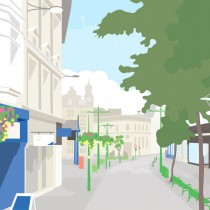
Below is an illustration I created to commemorate the closing down of Marks and Spencer, 9-12 Commercial Street, Newport. The grade II* listed building hosted Marks and Spencer until 2013. I am not exactly sure when Marks and Spencer moved into the
Below is an illustration I created to commemorate the closing down of Marks and Spencer, 9-12 Commercial Street, Newport. The grade II* listed building hosted Marks and Spencer until 2013. I am not exactly sure when Marks and Spencer moved into the
Fun and silly illustrations completed for The New School children’s book class I took. The teacher was Jacquie Hann. Pencil illustrations, scanned in and colored using photoshop. Top down: Octopuss; Penguin on my head; Gremlins; Peacock in my sneakers; Mess.
Fun and silly illustrations completed for The New School children’s book class I took. The teacher was Jacquie Hann. Pencil illustrations, scanned in and colored using photoshop. Top down: Octopuss; Penguin on my head; Gremlins; Peacock in my sneakers; Mess.
I started stone carving about 2 years ago. This piece is in alabaster and is about 8 inches across. This piece is inspiring by the Ikkanda family emblem (the Japanese “mon”). It is not finished yet! I was working on
I started stone carving about 2 years ago. This piece is in alabaster and is about 8 inches across. This piece is inspiring by the Ikkanda family emblem (the Japanese “mon”). It is not finished yet! I was working on
I think I first became aware of Kehinde Wiley about 3 or 4 years ago when I saw a thumbnail image in the NYTimes. I’ve seen his work at the Jewish Museum (“World Stage: Israel” March–July, 2012) and I just
I think I first became aware of Kehinde Wiley about 3 or 4 years ago when I saw a thumbnail image in the NYTimes. I’ve seen his work at the Jewish Museum (“World Stage: Israel” March–July, 2012) and I just